The first tornado touchdown has been confirmed following separate rounds of storms over the last few days in the region.
The National Weather Service announced on late Sunday morning, Nov. 14 the twister happened in New York's Hudson Valley, in eastern Dutchess County, in the town of Washington, on the first day of the back-to-back storms, on Friday, Nov. 12 at 11:15 a.m.
It rated EF-1 (the second-weakest of the six levels on the Enhanced Fujita Scale).
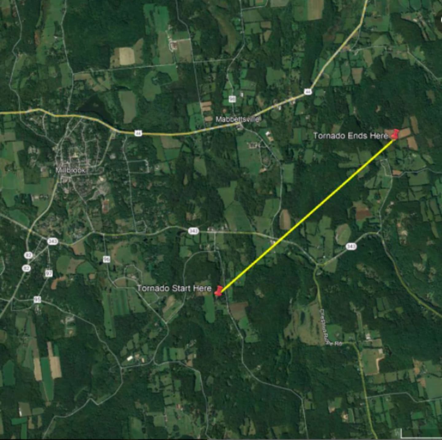
It had a maximum sustained wind speed of 90 miles per hour, an estimated width of 100 to 200 yards, and covered a path of 2.5 miles. (Shown in the image above.)
There was a 2.5-mile path of an estimated width of 100 to 200 yards, the weather service said, with an estimated maximum wind speed of 90 mph.
No injuries or fatalities were reported as a result of the twister.
Confirmations of tornadoes during the severe storms on Saturday, Nov. 13 could be announced either later on Sunday or on Monday, Nov. 15.
Enhanced Fujita Scale classifies tornadoes into five categories:
- EF0 - Weak, winds of 65 to 85 mph
- EF1 - Weak, winds of 86 to 110 mph
- EF2 - Strong, winds of 111 to 135 mph
- EF3 - Strong, winds of 136 to 165 mph
- EF4 - Violent, winds. of 166 to 200 mph
- EF5 - Violent, winds of more than 200 mph
This continues to be a developing story. Check back to Daily Voice for updates.
Click here to follow Daily Voice Westport and receive free news updates.